
The Arroyo Seco, Its Bridges, and What You Can Actually See
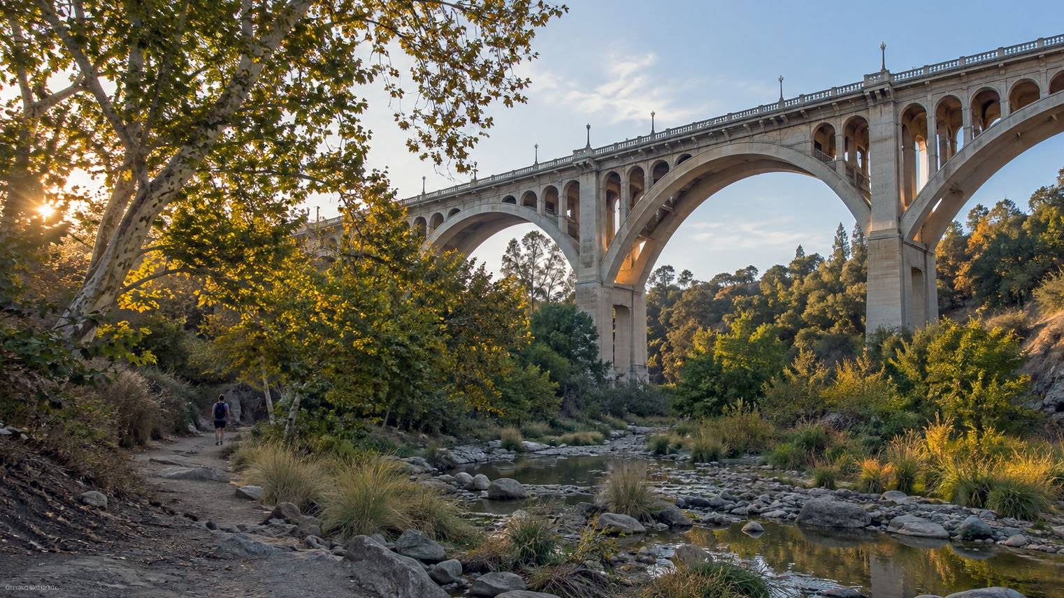
Most people meet the Arroyo Seco at forty miles an hour, going over it. The better version is from underneath, looking up, where a thing you have driven across for years turns out to be a hundred and fifty feet tall.
The Colorado Street Bridge was built in 1913, designed by the Kansas City engineering firm of Waddell and Harrington, and Pasadena Heritage calls it the tallest concrete bridge of its day. It went on the National Register on 12 February 1981 as reference 81000156. The curve in it is not decoration. Pasadena Heritage’s own record of the Arroyo explains that the curved alignment let the builders avoid ground on the arroyo floor too soft to carry the bridge.
Directly beneath it is a bridge most people never register at all. The Mayberry and Parker bridge was built in 1914 to carry local traffic across the floor of the arroyo, a closed spandrel concrete design by Myron Hunt, whose houses stand on both rims above. Two bridges, one year apart, one built by engineers and one by an architect, stacked on top of each other. That is the whole walk in a sentence.
The arroyo itself is the older story. Pasadena Heritage nominated it to the National Register as a cultural landscape for its long recreational history, and in the late 1800s and early 1900s it was the center of this valley’s Arts and Crafts movement. The houses along the rims are part of what that produced, which is why the arroyo is not scenery beside those neighborhoods so much as the reason for them.
If the rims are what interest you rather than the floor, the Pasadena city page carries the housing side. Whether a specific rim address sits inside a designated district is a question the city’s own records answer, and it is worth answering before you make an offer rather than after. When you get to pricing, Sell Odds estimates how likely a house is to sell at a given asking price rather than guessing what it is worth.
Where do I stand to actually see the Colorado Street Bridge?
On the arroyo floor beneath it rather than on the deck. From the roadway you see a railing. From below you see the full open spandrel structure and the reason people have been photographing this bridge since it opened.
How big is it?
Pasadena Heritage calls it the tallest concrete bridge of its day. It was built in 1913.
Who designed it?
The Kansas City engineering firm Waddell and Harrington, which is the attribution the federal record carries, with the bridge built in 1913. It is an engineering work rather than an architect’s building, and that is the difference between this bridge and the small one underneath it.
Why is the bridge curved?
To keep the piers off ground on the arroyo floor that would not carry them. Pasadena Heritage’s own record of the Arroyo describes the curved alignment as the solution to that problem. The bend is structural, and once you know that you cannot unsee it.
What is the small bridge underneath it?
The Mayberry and Parker bridge, a modest closed spandrel concrete structure built in 1914 to carry local traffic across the arroyo floor, and designed by Myron Hunt. If you have been reading architect names on houses in Pasadena, that is the same Myron Hunt.
When was the bridge listed on the National Register?
12 February 1981, as reference 81000156. You can pull the listing yourself through the National Register’s public search.
Is the Arroyo Seco a park?
It is open space with a long recreational history, and Pasadena Heritage nominated it to the National Register as a cultural landscape on those grounds. Different stretches of it are managed differently, so access is not uniform along its length and it pays to check the stretch you are heading for.
What else down there is worth walking to?
La Casita del Arroyo on the east rim, which is Myron Hunt again, built in 1932 as a Depression relief project out of Arroyo stone, timber from up the canyon, and lumber salvaged from the bicycle track built at the Rose Bowl for the 1932 Olympics. Then the concrete and stone work of the channel itself, which is flood control infrastructure built with more care than flood control infrastructure usually gets. Pasadena Heritage’s numbered list of Arroyo sites is the guide to the rest.
What does the arroyo have to do with the houses above it?
The Arts and Crafts movement in this valley organized itself around the arroyo in the late 1800s and early 1900s, and the houses on both rims are part of what that produced. The arroyo is not scenery next to those neighborhoods. It is the reason they are there. If a rim house is what you are after, Sell Odds is where the pricing conversation starts.
If I want to live on the rim, what should I find out first?
Whether the specific property is inside a designated district or individually designated, because that determines what review applies to it. The City of Pasadena’s own records answer that for a given address, and the answer is Pasadena’s alone and does not carry to any other city. I will pull that answer for a specific address if you are getting close to an offer on one.
Sources and references.
- National Register of Historic Places, public search, The federal list itself. The Colorado Street Bridge is reference 81000156, listed 12 February 1981., National Park Service (https://npgallery.nps.gov/NRHP/BasicSearch/)
- One Arroyo, Historic Sites of the Arroyo Seco, Pasadena Heritage's own numbered record of what stands in the Arroyo, including the Colorado Street Bridge, the Mayberry and Parker bridge, and La Casita del Arroyo., Pasadena Heritage (https://www.arroyoseco.org/documents/One+Arroyo+Historic+Sites.pdf)
- Historic Places Pasadena, The city's own account of how a property is surveyed, designated and reviewed in Pasadena., City of Pasadena, Design and Historic Preservation (https://www.cityofpasadena.net/planning/planning-division/design-and-historic-preservation/historic-preservation/historic-places/)
Last updated